
Our engineers are specialised in surveying for client-based requirements at different stages in projects such as pre-bid engineering survey, feasibility study survey, reconnaissance survey, detailed engineering, demographic survey to household survey with almost precision of location, boundaries, land layouts parcels which are carried out for Topographical surveying, Terrain Data Collection survey, Alignment survey (Road / Rail / Water / Oil & Gas / Power), DGPS and Total Station Surveying resulting in to achieve GIS framework like Digitization – Spatial Data – GeoDatabase resulting in the submission of contour maps – thematic maps – cadastral maps. Our team is also capable of handling Boundary surveying (Forest / Mining / Industries) with the geotechnical investigation of soil/rock/minerals. With the latest GIS software technologies and Survey equipment deployed under PHANS4 . We Expertise is involved in applications using –
Survey Engineering
SURVEY ENGINEERING CONSULTANT
About
DGPS Surveying
PHANS4 DGPS Surveying team has been providing clients with the preparation of plans, levels, topographical survey, alignment survey, inventory survey, household survey, locations data and generating contours at the required level of intervals under infrastructure sector like drinking water supply project surveying, transportation projects surveying, forest surveying etc areas with precision in cm and mm using advanced instruments from Leica and Trimble and software technologies for post-processing of the collected survey data used in marking GCP and Local Coordinates. Our DGPS Survey Consulting can execute –
- Block Level Surveying
- Bench-Marking
- Reference Pillars
- Topographical Survey
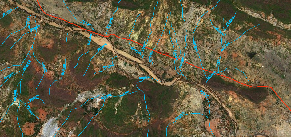
- GIS Mapping Consulting
- Contour Survey Consulting
- Maps (Survey – Cadastral – Satellite)
- L sections and Cross Sections
- Digitization & Geo Referencing
- Drawings & Reports
- Submissions
Total Station Surveying
Our team of survey engineers can provide accurate total station surveying outputs like
- Inception Survey
- Data Survey and Collection
- Elevations
- Control Points
- Boundary Surveying
- Route and Alignment Survey
- Preparation of Cadastral Survey
- Mapping and Submissions
GIS Mapping
Our engineers are capable of handling GPS/DGPS/TS and auxiliary process
- Feasibility Studies
- DPR Mapping
- Base Maps/Satellites Imagery
- Spatial Coordination
- Survey Points – Points/Lines/Polygon
- Georeferencing of data collected
- Contouring
- Land Developments
- Demographic Analysis
- Town Mapping
Drone Survey & Aerial Mapping
PHANS4 Aerial Drone Surveying professionals have the ability in capturing precise data and accurate mapping process and has been successful in determining the positions either in 2D and 3D Projections. Our Drone Surveyors provide clients with decision-making factors data areas where measuring points are difficult to approach. Drone surveying services include –
- Orthomosaic Maps 2D & 3D
- Mapping
- Site Surveying
- Locating GCP
- Point of Interests
- Data Processing
- Aerial Mapping
- Model Generation
We Offer Expertise In
ROADS & HIGHWAYS | WATER PIPELINE CONSTRUCTION | OIL & GAS | AGRICULTURE | IRRIGATION | URBAN & TOWN PLANNING
Projects Handled
DGPS and Total Station Surveying - RWSS
GIS MAPPINGDPR Survey preparation of the project using DGPS and Total Station Survey in the state of Odisha.
Topographical Surveying Consulting
DGPS/TS/Aerial Mapping - RWSSDrinking water supply project topographical survey engineering using DGPS surveying consultancy and Total station survey engineering with GIS mapping consulting in the state of Odisha.
Contour and Grid Survey - Canal
Polavaram - APWork Executed for Canal Alignment Contour and Gird layout for the proposed water supply project.
Lift Irrigation Survey Engineering
Madhya Pradesh - Morand GanjalConducted Lift Irrigation site survey and prepared Feasibility Report in the State of MP for proposed morand and ganjal lift irrigation scheme (drip/sprinkler).
Site - Contour - GIS Mapping
Odisha - Cluster 18Execution of 6 nos. of Lift Irrigation Schemes with intake points on Tel, Mahanadi, Indravati reservoir, Indravati, Ong, Suktel river having Command area between 500Ha. to 2000 Ha. in Cluster No. XVIII in the districts of Kalahandi, Bolangir and Bargarh including its distribution network, up to 1 Ha Chak having total planned Culturable Command Area of 9,547 Ha.
Koraput RWSS GIS Survey Consultancy
OdishaSurvey and GIS mapping of rural piped water supply projects pertaining to malkangiri & koraput district including five years operation & maintenance in epc mode.
Survey Engineering - RWSS
Golamunda - Odisha|
Execution of survey and engineering rural piped water supply projects pertaining to 28 gps of golamunda block of kalahandi district including five years operation & maintenance” under one package – on epc contract |
Khalwa Lift Irrigation Survey Report
Madhya Pradesh - KhalwaExecution of Khalwa Micro Lift Irrigation Scheme on “Turnkey” basis comprising of lifting of 11.22 cumecs water for irrigation in 35,000 hectares from Submergence of ISP reservoir for providing water with Micro-irrigation up to 2.5-hectare chak with residual head of 23 meters at 2.5-hectare chak. This includes work of survey, planning, design, drawing, estimation, Land acquisition/purchase, preparation and obtaining all statutory clearance, shifting and reinstallation of existing H.T. and L.T. electrical lines, Telephones lines, water supply lines etc. execution and installation of electric lines from M.P.P.K.V.V.C.L. substation to various pumping stations with all clearances from statutory authorities
Badnawar Lift Irrigation Survey Report
Madhya Pradesh - BadnawarConstruction of Piped Irrigation system to supply water through pressurized pipeline system for micro-irrigation (Drip/Sprinkler) to deliver at farmers’ fields up-to 2.50 Ha chak with a duty of 0.3204 Lit/Sec/Ha with at least 23 Meter Residual Head at each 2.50 Ha chak with total power requirement of 99.49 MW in Culturable command area of 50000 Ha, out of gross command area 74875 Ha,
How Do We Execute?
PHANS4 CONSULTING has a close-knit dedicated and organized team that consists of driving, dynamic and talented achievers. Among us are highly experienced ranging from 3 to 20 years skilled professionals in the field of Surveying through DGPS and Total Station, Drone Aerial Surveying and GIS mapping of RWSS, Lift Irrigation, Micro Irrigation (Drip/Sprinkler), Lake Development, WTP, ETP, STP, Watershed Management.